Wednesday, November 19, 2008

Redfish on a Fly, Part II


It's that time of year again. Tides are low and the water is clear. Reds are cruising in the bayous and tailing on the nearby flats. Vania and I shot some great video flyfishing for reds today.


This is one of three on a fly. We caught 12 fish total.
The biggest was 27" caught by Vania on a gulp.


Vania shows off a nice red caught on Gulp, from a different trip in the Mobile Delta...

Tuesday, November 18, 2008

Redfish on the Fly


Curtis Wright shows off this fine 26" red caught on an 8wt flyrod.


Jason worked the push pole as we stalked this redfish in the shallows.


Thursday, October 23, 2008

Misc Fish Pictures


White Trout that a shark hammered.


Nice Mississippi Sound Trout - August 2008


Nice Limit of Trout from the Causeway 10/20/2008


Vania in the Native Ultimate filming Fox Ten Outdoors


Monday, April 07, 2008

Weoka Swim & Lower Hatchet

We arrived in Coosa County, still raining lightly on Saturday morning around 9am. Looking at radar precip, it looked like Lower Hatchet, Swamp, and Weoka would be our best options. We opened the morning up with the easy 8 mile run from Kings Bridge to Lake Mitchell on Hatchet. I mtn biked the shuttle (about 9 miles) took the north side of the river route/CR 18, there is some dirt road here. River was around 700 cfs and rising fast. No problems, class I shoals, and some longer flatwater stretches. Scenic most of the way. Dogwoods, Mtn Laurel blooming. Some stripers were running up the creek too, from the lake, didnt fish. Deer, turkeys, ect. Light mist and 65 degrees, cozy. A glance at Swamp, showed it was running good. We had run this last year, so we opted for something different for run #2. Looked for a lunch spot in Rockford - no dice. We headed down to Weoka, knowing the bulk of the precip fell in its watershed. I would estimate 3" fell in the basin. Mike navigated, while I drove. We miscommunicated about the put-in bridge. We unknowingly unloaded our boat at CR 429/Buyck Road.. By the time I drove south I realized we were 4 miles up river from the Sewell Road/CR 432 put in. Oh well, I headed on down to the bridge at Lake Jordan, Weoka Mills. I left the truck here, and biked the extended shuttle without totally scouting the shuttle route. CR 433 above Titus/Grays Ferry Road was soft, muddy dirt - It was nasty. There was my second out-of-shape shuttle of 8 miles with no lunch. So we had a six mile paddle to the lake, with the time about 4pm, just enough daylight for the run. The river was pushing 3 chickens, muddy and strong. You have to look at the radar precip, not the Hatchet Gauge to get the idea. I would say there was easily a 800 cfs in the streambed at launch, with more dumping in from every tributary. The "upper" Weoka run wasnt bad. It moved fast, we had some I-II water here and there. Below the Sewell road bridge, the first mile was also I-II, and moving fast. Then we hit the bigger stuff at the end. The first good rapid was a straightforward II+. We both took on a little water, no problems. Then we got to the bigger boy. The site lists this at III-IV at higher water. I would give it that rating at the level we experienced. It has an initial drop that must be run left of center, followed by a left of center S-turn drop that had a big hole towards the center of Weoka. The washout boulder garden below was in the class III range and ran about 50 yards. We scouted, I decided to run it first, directly, with no throw rope set up.. Bad idea! I have run stuff this bad before, no big deal. No lunch, the last rapid of the day, 17 miles of shuttling on a mtn bike... Hit the main drop off line to close to the hole in the center and flipped. I hit a low brace and my paddle was in the hydraulic. I couldn't roll up the massive 15' MR explorer despite thigh straps and a pedesal. Screw it, I'm swimming .. I had my buddy Curtis' PFD on, and it was an adult small jacket, Not enough. So I off to swim the III washout for the whole 50 yards, swimming hard to avoid the holes and getting a mouthful of water everytime I needed a breath. By the time I eddied out down at the bottom, I was too spent to chase the canoe. I took about 15 seconds to compose myself on the river bank and Mike comes crashing down through the woods. "Are you alright ?" "Yeah, that Sucked ! " So... after a breather, or three, I talked it over with Mike. I would paddle the other boat through, cheating the drop to the far left, on the 3' and 4' double drop ledges, and avoid the bad stuff, navigate the washout, and paddle out tandem to go get the other boat. That went off without a hitch. We got to the old mill dam. I have seen pictures of it before, of people running through the slot in the dam. The river was pouring over the whole dam, and doing so too good for my taste, plus we had a canoe stuck in the washout below the dam. So, we carried around and ferried over to the canoe, One of the bow lines was wrapped in some debris, and she was a little hung up, but broke free with a little shove. A testament to not having bowlines, or having them secured. A few nicks on the IQ gunwale , but otherwise, in good shape. The unmanned canoe had run the dam upside down, without issue. A testament to full floatation. I lost a 54" or 56" bending branches wooden paddle, with rockguard... No major bruises, and just worn down to nuthin. Fun day of Central AL boating/biking and lots to talk about on the way home.

Tuesday, February 26, 2008

Hidden Delta Lakes


Shallow and stumpy ditches lead to the lake


Sean and I drag the Lasarge, Vania works the push pole


We arrive at this lake in the Heart of the Delta


First Bass of the Day - Spinnerbait


Vania holds a 3 pounder, 7 Bass & 3 Crappie for us total


Alves shows off a solid slab


The Sullivan/Alves total, 20+ Crappie !


Sunday, February 24, 2008

Walnut Creek


Walnut Creek and its short drainage area begins on the upland hills just west of Clanton, AL. It flows under I-65 as a sluggish, pastoral stream. Just east of the interstate, Walnut takes on a significant change of character. Other small tributaries add to the flow. Below CR 32, gradient increases and you will find almost continuous action in the 3.5 mile section above Lake Mitchell. Three rapids are particularly challenging and reach class III. This is a tight, technical creek that has surprising drops compared to most streams in central Alabama. This run is for experienced paddlers. It is lot of fun at decent levels. The only real issue with this run is finding a place to take out. There is no public access point at the end of the creek on Walnut Creek cove on Lake Mitchell. If you do try to adlib your way into using someone’s lake house as a take out, please be very polite and courteous. The local people along the lake are generally very friendly and helpful.

Trip Report

Level: Medium/Good
Flow: 2000, falling to 1500
Gauge: Hatchet Creek
Clarity: Stained/Muddy
Weather: Near 40 - Cloudy skies
Section: CR 32 to Lake Mitchell

After a drought year in 2007, February of 2008 is turning out to be a nice return to more normal spring paddling conditions in Alabama. A very nice 3.25” rain fell Thursday night (2/21) and early Friday morning (2/22) in Central Alabama. Calera reported over 3 inches in the rain gauge. Alex City also showed 3+ inches. Radar estimate precipitation verified that the Walnut drainage saw similar amounts. Hatchet Creek peaked at an impressive 7,000cfs on Friday around noon. We talked to a local paddler who checked out Walnut on Friday. It was blown out on Friday – too high.


Two gum trees at the put in, upstream of the bridge/north side (upstream river right)


When we arrived Saturday morning, the level was just about perfect. It was exactly 24 hours since the last rain. Normally you might miss the water at this point, but it was a big rain. We could see the water line was a good three feet higher the day before. For reference, the Hatchet Creek gauge was at 2000cfs when we launched and continued to fall to around 1500cfs by Saturday evening. Alabama whitewater lists 700 cfs on Hatchet as the minimum for Walnut. This level would work if Hatchet is rising or, in the process of peaking. The Hatchet Creek watershed is very large, and the gauge should only be used as a general reference for the small watershed of Walnut.


David having fun in a nice class II drop


We met a couple of kayakers from the Tuscaloosa area at the middle Clanton exit (208). From there, it was only a short drive to the put in. The river level looked good at the bridge. The forecast called for 62 degrees and sunny on Saturday. Wouldn’t you know it was 38 degrees and cloudy. The high on Saturday was only 40 degrees and we never saw the sun… Good thing I had a wetsuit, a layer of capilene, and a nice MTI jacket and pants. This outfit (along with wool socks doubled with neoprene socks and paddling shoes) proved to be adequate, on what turned out to be a wet day near the end. Curtis and I have paddled several creeks in the Coosa/Chilton county area, and this one is by far the best.


Curtis landing into a sticky hole, straight on drop


We found that Walnut starts off quick and is pretty much non-stop until the lake. The class III rating is very accurate. Three of the rapids are genuine III’s. The first drop reminds me of a miniature version of Dick’s Creek Ledge. The second good rapid is more “straight on”, but has a sticky hole at the base. The final rapid before the lake is a classic III. There are also only small eddies and very short pools to recover in, along this creek. Running this thing tandem without flipping would be a significant accomplishment.


Stickier hole for some of the kayaks...


I will protect the identity of the guilty in this report, but one our kayaking friends who paddled with us was really caught by surprise Saturday. Lack of sleep, no breakfast, a thin wetsuit, a trip or two on the lower mulberry, a recreational kayak with a lake paddler’s spray skirt, no roll, temperatures in the 30’s at launch, swimming very early in the run, almost non-existent recovery pools… You get the idea. I think we lost count around swim number six or seven. Once you start to get as cold as that, it’s hard to get you confidence up and paddle effectively. After multiple rescues and recoveries, we tried a different approach. Towards the end of the run we had to load the kayak up on top of Curtis’ 15’ Explorer. I paddled him out tandem in my 16’ for the last two miles. The other kayaker that was with us had a clean run and really liked the creek. Curtis had a clean run and even survived the III at the end with the kayak fastened to his canoe. My tandem attempt on the last rapid was not so pretty. For the first time since owning the 16’ Explorer, I swam. To be honest, it was probably the most fun I have had paddling in along time.


Swifty extraction :)


The lake paddle at the end was about a mile more or less. We lucked into a fantastic take out spot on river left. This was on the north side of the lake, off CR 264. The shuttle is painless, the lake paddle is not too bad. The run is definitely on the do again list. I honestly would have liked a little more water for the big long canoes that we are currently paddling. I want to try Walnut again a little sooner after a rain. 3 miles of II-III water 3 hours from Mobile. It’s the closest good water to my casa. BTW, the El Torito in Prattville is pretty good. Try the “M.”

Saturday, October 20, 2007

Thursday, August 09, 2007

Assorted North Carolina Photos 2007


Nantahala Falls in Our Open Canoe


Upper Tuckasegee River, NC


Backpacking in Panthertown Valley, NC


Big Rainbow Trout on Fly Blue Ridge, GA

Tuesday, April 17, 2007

Swamp Creek


Swamp Creek

Swamp Creek is a headwater stream with a short watershed located in southern Coosa County, AL. It doesn't look like much of a run from the road access points at US 231 and HW 22. However, this stream offers one the most challenging stretch of rapids this far south in the central part of Alabama. There are two other shorter runs in the area that have good drops too, Weoka and Socapatoy Creeks, that we hope to paddle another time.

Swamp Creek is not as consistent as Hatchet Creek in its shoals and drops, but its definitely more challenging in places. It does have two short sections of surprising gradient, with rapids that approach Class III in the upper section. This bi-polar creek begins with a long stretch of flatwater, followed by an intense sections of drops and falls.

The scenery is pretty decent during the sections of increased gradient. Rock banks bend and twist among mountain laurels and hardwoods. There is very little sign of civilization. You will pass the occasional deer stand or small camp along the way.

The clarity of this stream is poor when water levels are high enough to run. The streambed is also choked with sediment in the flat sections, due to clear cut logging along its drainage. It is also prone to logjams in places. The fishing might be decent if you wade it during low water periods. It is silted in pretty good and I bet snakes are a problem in the summer. Watch for red Mad River Explorer paint on some of the rocks at lower water.


You need to catch this small creek right after significant rains. Alabama whitewater lists the minimum for the stream at 700 cfs on the Hatchet Creek gauge. I wouldn't try it any lower than 1000 cfs, and make sure the Hatchet level is steady or rising when you put in. Hatchet Creek's watershed is a good bit north of Swamp Creek. So, it would be a great idea to check out the latest storm total precipitation levels from the Birmingham Radar site. You need 2-3" of very recent rain on top of a decent base flow.

Trip Report

Level: Too Low
Flow: 950, falling to 700
Gauge: Hatchet Creek
Clarity: Stained/Muddy
Weather: Mid 50's - Cloudy skies
Section: US 231 to Kelly Crossroads Bridge

Upper Swamp

The Hatchet level peaked at 1,200 cfs at 8am Sunday, April 15 as we drove up to Coosa County from Mobile. We were optimistic about the run of Swamp Creek, which has listed minimum of 700 cfs. Unfortunately, the low water table and short watershed didn't work in our favor. The Hatchet gauge fell to 950 cfs by the time I had biked the 13 mile shuttle. Curtis noticed the visual level on Swamp had dropped 2-3" in an hour or so while he got the boats loaded out with floatation. Little did we know that the Hatchet level would fall to 700 cfs. Swamp was probably down to a mere 100 cfs or so by the end of the day.

Swamp Creek starts out flat, with a shallow silted bottom. Several tributaries join the flow along river right and add some volume. The first signs of gradient appear about 2-3 miles into the run. Swamp goes abruptly from virtual flatwater, to significant rapids and drops. The first real good rapid is a boarderline class III drop of about 6'. After scraping through some of the initial shoals, there was good reason to hope for decent day after running the six foot falls. Curtis ran it first with no trouble. I ran it too - clean -with no scraping.

The next class II drop of about 4-5 feet was not runnable as the river became wider. The shoals were also rocky and troublesome. There is a small dam in the midst of the whitewater, but its easily portaged on the right side. We did technically run the double drop below the dam. This is definitely class III with some decent water. Both Curtis and I survived the double drop, only to get hung up on the rocks at the base of the rapid. After a good stretch of rapids that lasted for about 2 miles, the gradient ended and we paddled out through logjams strewn along the streambed for the remaining 2-3 miles. A tornado must have gone through the day before just above the CR 22 bridge. A dozen large trees with fresh leaves lay in the streambed. All in all we dealt with 10-15 logjams that required some significant maneuvering. At this level, we were able to squeeze over and around most of them. Higher levels would get you over some logs more easily, but the strainer danger would be higher too. Be careful.


Lower Swamp - 3 miles

We paddled both sections for a combined 11 miles of dragging and dodging rocks in low water...

Lower Swamp is an easy, short run that also starts out very flat. I did not scout the access point at the HW 22 bridge as we paddled past it... But, reports are that you can find decent parking and access. The gradient picks up a good bit in the sedcond half of the run. You will find a number of ledges and smnall drops. The drops on the Lower Swamp are not as challenging as the two decent class II+ drops in the upper Hatchet (280-231) run. This is also a much easier run than the Upper Swamp.

It also widens out quite a bit in places, yet has a much smaller drainage than Hatchet. The result is that you need a lot of water. I would recommend at least 1,000 cfs on the Hatchet Guage and/or recent significant rain to enjoy this section. I wouldn't float this section again unless:

#1 I had a lot of water - 1500 cfs+ on Hatchet
#2 I was in the area and short on time
#3 I had beginner paddlers and was/or floated it tandem

Monday, March 19, 2007

Yellow River

The Yellow River begins above north of Opp, AL as a small creek. It joins Lightwood Knot Creek and these two streams form Lake Jackson. As the Yellow continues to flow through Covington County, it makes the transition from a small stream to a full sized river. The Yellow is normally run below HW 55 at Watkins Bridge. This section in southern Covington County forms the border of the Conecuh National Forest. There is very little development along the river. You will only see the occasional camp or access point.

Both largemouth and spotted bass are found in the Yellow River. The spotted bass are more common between Watkins Bridge (HW 55) and Givens Bridge (SR 4). You will also pick up small bream. This section is ideal for small boats and canoes. You best level for floating is 300-800cfs. There are no significant shoals or rapids. You may have to get around a logjam or two, especially near the confluence with Five Runs Creek.

The river becomes wider and the current slows down below Givens Bridge, largemouth become more common. Redbreast, redear and bluegill sunfish are also plentiful. Keep in mind that motorboats are also more plentiful below Givens Bridge and into Florida, because of deeper water and easy access with public boat ramps.

Trip Report

Level: 81.3 Flow: 500 cfs (steady)
Gauge: Yellow River at Oak Grove
Clarity: Clear
Weather: Mid 60's Saturday, Near 30 Saturday night, Low 70's Sunday, Clear skies
Section: HW55 Watkins Bridge, AL to SR 2 Oak Grove, Florida

Section I
Watkins Bridge (HW55) to Givens Bridge (SR 4)
Distance: 11 miles

The access below Watkins Bridge is downstream river right. There is a narrow dirt road that takes you 50-100 yards downstream. Here, the bank is not as steep as it is at the bridge. You will find an easy access for canoes or perhaps a small jon boat. There is no boat ramp here, and this section can contain minor logjams and obstructions. This is mostly a section for paddlers.

This upper portion of the Yellow River winds along with occasional rock formations. Low sandbars are present as the river makes deeper bends and turns. Most of the sandbars are suitable for camping as long as the gauge is below 800 cfs. Higher water will result in challenging fishing conditions and fewer possible camping spots. The river is not quite as clear as other blackwater streams in the area. However, you will notice very clear, spring fed tributaries entering on both the east and western banks. Wildlife is common along the river. If you are quiet, you may see deer, turkey, wood ducks, and the occasional beaver. Kingfishers, pileated woodpeckers, hawks, and owls are also prevalent along this remote waterway at the edge of the national forest.

There are two distinct areas with small rocky bluffs and deeper holes. One is found only several miles below the put in. The other is only a mile or two below the entrance of Five Runs Creek. There is good potential for spotted bass in these areas. There are also small boulders scattered along the bottom of the Yellow in a few spots. The woods can be very pretty in the early spring with dogwoods in bloom, red maples budding out, and the trees pushing out bright green leaves. Cypress trees are also common along the banks of the Yellow. The fishing was extremely challenging considering the post frontal/midspawn conditions. However, the scenery was nice, and we saw a lot of wildlife. Compared to other rivers in South Alabama, you may be surprised at how clean the river was. There is very little trash along the way.

Section II
Givens Bridge (SR 4) to Oak Grove, FL (SR 2)
Distance: 8 Miles

The access at both the put-in and takeout is excellent with public boat ramps at both locations. There are several long and straight sections as the river flows southward. You will also encounter several tight bends with logs along the banks. There is a clear route for small boats down to levels around 400 cfs in this section. Expect to see motorboats fishing for bass, panfish, and running trotlines for catfish.

There are several nice sandbars along this route. You won't find the rocks or boulders. There are also small sloughs and slack water areas off the main channel. Hardwood forests and cypress trees line the banks in many areas. There are some areas where pine trees come close to the rivers edge, but timber management practices seem to be more river friendly along the Yellow in both states.

This section is perfect for a half day of floating. Small plastic baits, crankbaits, and 1/8-1/4oz spinner baits are a good bet for the largemouth and occasional spotted bass along this section. Beetle spins, crickets, and worms will work for the panfish. With the increase in boat access, the fishing pressure makes the bite tougher here.

Tuesday, February 13, 2007

Styx River


These are photos from Styx River, Elsanor/CR87 to Seminole.


Aaron White of Great Days Outdoors Magazine is pictured with a nice largemouth.


Aaron shows off a chunky Spotted Bass.


There are a lot of log jams on this section. Trip report is coming soon...

Saturday, February 10, 2007

Big Escambia Creek 5/4/2006


*Updated photos from our Fox Ten Outdoors shoot on Big Escambia February 2007.


*Vania Kuy, Fox Ten Outdoors photojournalist shoots video of likely fishing spot.


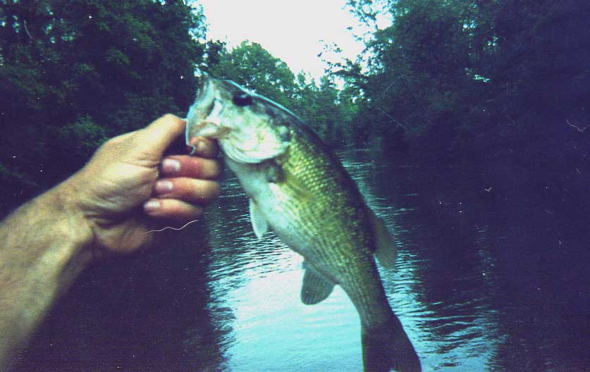
* Vania takes a break and hauls in a nice spotted bass at the confluence of Sizemore Creek.


*We boated 20-25 nice spots. The largest was close to 2 pounds.


Big Escambia Creek forms near Frisco City in Monroe County and flows south through extreme S'west Conecuh County. The creek is reported to be covered with numerous log jams between CR 30 and I-65 as it enters Escambia County, AL. However, below I-65 there are some interesting sections to float up to the town of Flomaton. There is a clear 12.5 mile section from Sardine Bridge(CR 27) to Flomaton, with another access point halfway down this run at Murray Branch Road.


Big Escambia is a typical clear blackwater stream, and is very similar to it's nearby cousin, Little River which flows on the Monroe Baldwin County line. There are gravel bars, rock formations and occasional white sand bars. Overall, the drops and rock formations are more interesting on Big Escambia, but water quality is better on the Little. Big Escambia cuts through rock and clay, and the first 9 miles from Sardine Bridge (Cr27) contain some minor shoals that are borderline Class I. Unfortunately, gravel mines and clear cutting take there toll on Big Escambia as you get further downstream. The sediment is an issue keeping the river pretty shallow as you approach Flomaton.

Trip Report

I had a business trip in the Huxford, AL area on Thursday morning, and the rest of my afternoon was free. It only took one quick look at the Delorme Map book and a trip to Big Escambia Creek was in the works. This trip ended up being a solo experience and it was a rare treat. I called a friend, Jerry Hawsey, from the Brewton area who was very kind to help me with the shuttle. Special thanks to Jerry! The trip turned out to be perfect.


We have had several months of drought across the Gulf Coast, and most rivers are running quite low. This makes for excellent fishing, however, the streams can actually be too low to float. After Driving to the Sardine Bridge and looking at the 2.2 foot level (usgs), I went a little further downstream. I decide to float from Murray Branch Road to Flomaton (Us 31) making for a 6 mile trip. Sizemore Creek comes in above this lower section and adds substantial volume .


I drove into Flomaton and checked out the easy take out access on river right (N'west side of US 31), ate at Hardees, and went back up to Murray Branch Road. The put-in at Murray Branch is good, you have to try several dirt roads to find the best spot. This is a locals hangout from the looks of the trash scattered around. The put-in scenery gets a D-, but this is soon forgotten.


I began my trip around 1pm and planned to fish hard and paddle very little. The first two miles of Big Escambia had some twists and turns, along with a few very minor rock shoals. I began to catch fish pretty quickly. At one shoal area, there is an interesting lagoon on river left that you can paddle into. I caught one fine bull bream there on my flyrod. I picked up some small spotted bass throughout my float, mostly behind log jams. I caught a fish on a beetle spin, and one on a worm.. The rest were all caught on a #6 Frugal Frog Betts popping bug. The river slows down and gets more choked with sediment, but I did catch three bass near the powerline cutover 1.5 miles above Flomaton. The highlight of the day came when I caught a 2+ pound largemouth on a fly in this area. Most of my bass that I caught on a fly, hit when I was wading. When you canoe float fish these blackwater streams, its a good idea to get out and wade from time to time. Whenever, I see a deep cut against a high bank, with log jams that create slackwater eddies its time to pull over... I stop on the adjacent sand bar and wade fish so I can make a better presentation


Overall, the put-in was trashed and the river was pretty in most spots. I did hear a gravel mine in operation, in one small section. Otherwise, I saw no cabins, and no people for 5-6 hours. There were a few herons, a red headed woodpecker, and a water moccasin along the way. The timing worked out well. Jerry said he would be done with work by 6:30 pm. I saw the Flomaton bridge about 6:20pm and called on the cell phone, which works well at the takeout in the heart of Flomaton.

Monday, February 05, 2007

Brushy Creek, AL to MS


This Brushy Creek has a neat canyon feature a few miles below the put-in.


**This is not Brushy Creek in the Bankhead National Forest
***This stream is in lower Alabama (and MS)

There are countless small waterways that are named "Brushy Creek" in the state of Alabama. This particular Brushy Creek is a tributary of the Escatawpa River that has some interesting shoals, followed by very challenging logjams.

The stream begins in Greene County, MS near the community of Pisgah. It flows southward into George County, MS. Scarborough Creek and Tennesse Creek add to the flow. Brushy becomes just large enough to paddle at Brushy Creek Road. Then the flow begins to head southeastward for four miles, crosses the Alabama line, and flows another 1.5 miles before hitting the Escatawpa.


Here is another shot of the unique claystone ledges.


The stream cuts through a layer of sandstone and claystone with gradient of about 7 feet per mile. There are several extended shoal areas in this twisty, swift area of stream. You also will encounter one class I drop of about three feet. Much of the land along the creek is posted. Proceed with caution. You will see several cabins along the way. The flow flattens out two miles above the Escatawpa. The streambed becomes sandy in nature, and the occasional logjams become more numerous. Brushy enters the Escatawpa 2.5 miles above the HW 98 access.

The best way to navigate Brushy Creek would be in a small, light tandem canoe with two paddlers to help carry over the logs. A small sit on top kayak would also work very well. The creek is very narrow and paddling a longer sea kayak would be problematic. Sit-in kayaks like "Pungos" might work, but it would be more dangerous due to the logs and strainers. Pack a light amount of gear to make the portages easier.


Logjams and spotted bass co-exist along Brushy.


From a fishing perspective, it would be difficult to flyfish. The creek is just too tight. A short 5 to 5 1/2 ft. spinning rod with 6 lb. test is ideal. The spotted bass fishing is very good. They like 4" worms and small spinnerbaits. Bring some small beetle spins, because and there are also some very pretty longear bream that locals call "sun perch." See the report below.


The best way to gauge the level on this creek is the Big Creek level, above Big Creek Lake. This is a similar stream, though slightly smaller, that is located 5-10 miles to the east of Brushy. Here is my best guess in translating the levels between Big Creek and Brushy Creek. High levels could be dangerous due to the numerous logjams and strainers. For a visual level, if you can run the first shoal just downstream of the bridge, you should be fine.

5.5ft, 200 cfs - High
4.5 ft, 100cfs - Medium (Best)
3.5 ft, 50cfs - Low (Best for Fishing)
3.0 ft, 40 cfs - Minimum


Curtis shows of a nice Brushy Creek Spot.


Trip Report

Level: 3.0
Flow: 48 cfs (falling slowly)
Best Gauge: Big Creek above Big Creek Lake, or visual.
Clarity: Clear
Weather: Upper 50's, Cloudy
Section: Brushy Creek Road-HW 98 (5.5mi on Brushy, 2.5mi on Escatawpa)

Curtis and I paddled Brushy on Sunday, February 4th 2007 in a tandem Mad River Explorer 16'. A shorter 15' canoe would have been even better. The question is, are the logjams worth it? The fishing is really good and the shoals are neat. The logs are especially bad in the lower section, partly due to Hurricane Katrina. They slow the trip down big time. I am ready to do it again. Curtis says he would prefer a more open stream like Little River in Baldwin County or Big Escambia Creek.


Most fish were 1-2 pounds...


We set out from Mobile at 10:30am, arriving about at the Brushy Creek Road put-in bridge 45 minutes later. We unloaded the canoe and fishing gear. Curtis' road bike was our shuttle. We decided to flip a coin to see who was going to have ride the bike back up.

The idea was to drive the truck with the bike in the bed back to Escatawpa Hollow, and leave the truck there. The unlucky loser then had to bike it up HW 98. And, then turn right and peddle north on Beaver Creek Road until it merges with Brushy Creek Road and the bridge. The winner got to set up the canoe and gear, and then ease upstream and fish a little. Curtis called heads, the coin said tails. Curtis had to ride. The agreement was that I get to bike the shuttle next time.

I was a bad judge of time. Curtis waited 20 minutes at the bridge while I fooled around with some spotted bass upstream. We finally got on the creek about noon. I told Curtis I was sorry he had to wait. But, that he would love the creek. It was full of fish. Curtis said "I booked it down 98, and it wasn't fun with the 18 wheelers. But, the ride up the country road was great."


This pose is beyond cheesy.


We caught fish right away. We caught six fish out of one pool in the first mile. The spots were hitting 4" black finesse worms with a 1/0 EWG Gamagatzu hook and 1/8 oz. or 1/16 oz. screw-in head weight. I also had good look with the 5" Gulp shaky worm. Throughout the afternoon, we caught a good 20 or so fish. Some of the spots were smaller - around a 1/2 to 3/4 of a pound. We both caught several fish well over a pound. The fish were found in most of the deeper holes and bends. The ones we didn't catch were visible in the clear water as we canoed downstream. Later in the run, I switched to a small 1/8 mini king spinnerbait. It seemed to work just as well.

We encountered some really neat shoals in the first 3-4 miles. There were several sections where the light shoals would continue for 50 yards or more. One drop was a definite class I, even at this lower level. It was a good three foot ledge. I would imagine it would be very fun when Big Creek is running a 100 cfs or so. The upper section did contain a few logjams, but nothing major.


Holding onto a branch with your teeth keeps the boat still and both hands free for fishing.


The fishing seemed to slack off a little towards the bottom. We still caught a few, but the holes were not as deep. You also would find the holes right behind the log jams. By the time you got the boat over the jam, the fish were spooked. We were also in a hurry. We were running out of daylight. In the last mile or two, we were hoping the Escatawpa was right around every bend. Instead we found some tricky logjams. Most were low enough that we could slide the boat over the log. Some logs were low enough in the water to slide over. Twice though, we had to get out of the creek and carry through the woods.


Escatawpa at night. There are more photos on my 35 mm that show Curtis and the Creek. Coming soon.


We reached the Escatawpa just after sunset. It was pretty much dark. We had a good 2.5 mile paddle left. The Escatawpa was pumping at 1230 cfs so the current helped us along. The sandbars stood out in the fading evening light. A full moon rising in the east brightened the sky a little. We made good time in the swift current. It wasn't long before the noise and lights of HW 98 appeared in the distance.

It was a challenging paddle and six hours is not enough time if you plan to fish.