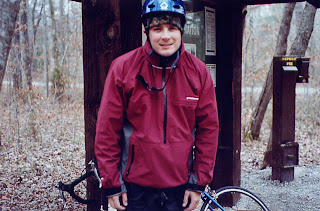
The entrance to the Bankhead coming from the north side and Wren, AL on HW 33 .
After paddling the Upper, Upper Mulberry, I headed for my real destination - the Bankhead National Forest. My goal was to spend three days and two nights exploring Brushy Creek and the Sipsey Fork.
This all started in early January, when I learned that I had four vacation days left over from 2006. I had to take them in the next few weeks, or I would lose them. It would most likely be time off during the week, in the coldest month of the year. I was going to be vacationing by myself. Nobody else would be interested in running rivers and camping in the cold weather. To me, I knew it was an excellent opportunity to enjoy the outdoors in Alabama on my own.

Brushy Lake
I spent several days before my trip looking at computer models and forecasts. There were two possible trips depending on the weather. I was either going to Southeast Alabama to float the Choctawhatchee and the Pea Rivers, fishing for Spotted Bass and camping on sandbars. Or, I was going to the Bankhead to maybe hunt, attempt to fish, and definitely canoe camp in the colder weather. I also was going to be biking my shuttles. I found the roads in the Bankhead to be fantastic to bike on.

Wide open roads with little traffic.
The forecast pointed at a heavy rain the north part of the state on Sunday. That system was to stall out in the southern part on the state Monday through Wednesday, leaving the north dry. Monday through Thursday was my window of opportunity. I headed north through the rain, catching the higher water on the Mulberry Monday afternoon. I stopped ion Cullman for the traditional Mexican feast at the local Loopy's. Then, I pushed west on U.S. 278 through Addison, and north on SR 63 to Brushy Lake campground. There are two maps that are very helpful in this area besides the Delorme map book. You can order at water resistant Bankhead map from Carto-Craft Maps 205-822-2103, and you can download the Black Warrior WMA hunting map.
The Carto-Craft map is the best, and is also available at the stores in Wren, AL north of the forest.

I had the place to myself.
I found the campground completely empty. I was perfect. There was no water and no electricity. There was a bathroom with a chamber pot toilet that was fairly clean. I found 13 sites to choose from. I picked a spot with lake view that was in the central portion of the campground near the bathhouse. The sites were level, clean, and had a nice table to cook on.

A cozy site.
The 33 acre lake is clear and very pretty. Brushy Creek and Owl Creek enter on the north end and keep a steady flow of clean water that drains the protected forest. There is a day use area close to the lower end. Brushy Lake offers fishing form bass and bream. I'm sure it gets some fishing pressure in the warm weather months. A short paddle around the lake, and a fairly short portage around the dam on river right brings you to the start of the remote 10 mile paddle on Brushy Creek. It was a nice place to get a good nights sleep right at the put in for tomorrow's float.


No comments:
Post a Comment