Mulberry Fork at the BCC takeoutThe Mulberry Fork of the Warrior is one of the most consistent and popular whitewater runs in the state. Near the Cullman - Marshall County line, the Mulberry forms close to the town of Arab (pronounced A-Rab). The water quality is fair, and can get pretty muddy above the USGS gauge level of 4.5 feet. There are a large number of chicken houses in the area, as well as other agricultural impacts. However, the bluffs are scenic and the Mulberry is a nice low gradient, high volume river with nice waves.
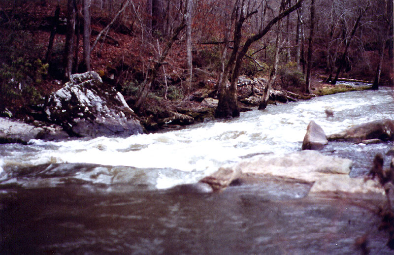
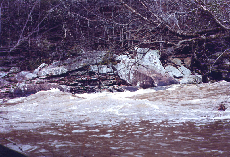 Hawaii 5-0 Rapid at 6.5 feet
The Lower Mulberry Fork is the section below U.S. 31 at Garden City. It provides straightforward class II action with good play spots. This section can be run at levels as low as 3.8 feet, and is usually running in most of the winter and spring months. It also can develop some very impressive wave trains at higher levels of up to 7 feet. The take out for this short 3 mile section is at the Haiwai 5-0 wave playspot at the Birmingham Canoe Club parking area. This is also the site of the Mulberry Fork Races each spring. This is an extremely popular stretch of Alabama whitewater. The best fishing would be at levels below 4.5 feet. The river clears up nicely and spotted bass are plentiful. It would be interesting to float below the BCC takeout and fish the river to Black Bottom or Sloan. This could be done in a canoe at levels in the 3'-4' range.
The Upper Mulberry Fork is considered to be the 6.5 mile section between County Road 10 and U.S. 31. This section still receives the extra volume of the Duck and Broglen Rivers which enter just above CR 10. It does need a little more water - say around 4.5 feet - to be running well enough to enjoy the whitewater action. All the rapids are straightforward class II's and like the lower section, produces bigger and bigger waves at high levels. The section is a nice rollercoaster ride above 5'. Below 4.5' you might drag some, but the river runs clear and the fishing would be good.
There are some other options above these two sections if the water is up. But, like many Alabama streams at their headwaters, a good whitewater floating level is usually too high for fishing. The low gradient section between County Road 51 and County Road 10 could make a decent float fishing trip at levels around 5 feet. Above County Road 51, you pretty much have to wade it it at levels that are fishable. The minimal float for class I-II whitewater between U.S. 278 and County Road 51 is 5 feet.
So that leaves the section above U.S. 278. Alabamawhitewater.com refers to this as the Upper, Upper Mulberry Fork of Warrior. This is a nice class II+ section that can be run after recent rains of 1.5" or more. This headwater run begins at State Highway 67, and is only floatable when its too high to fish. Ideally you want a rising level above 5.5 feet on the Garden City Gauge. As of early 2007 there are several logjams that you have to go over or around, but they are worth the effort if the water is pumping. There is very little flatwater, and the pools are short.
Trip Report 1/22/07 - Upper, Upper Mulberry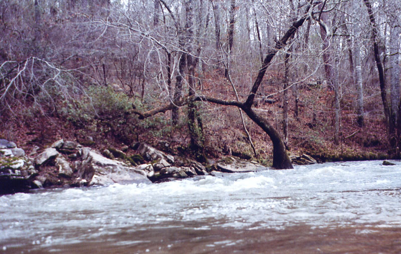 A class I shoal near the put-in
Level: 6.2 ft
Flow: 2100 cfs (falling fast)
Clarity: Stained
Weather: Upper 40's, Cloudy
Section: HW 67 - US 231 (Near Holly Pond, AL)
I had some leftover vacation days to take in January, and choose to head to north central Alabama for some solo camping, paddling, and cycling. My goal was to spend most of my time in the Bankhead National Forest, but I wanted to catch the Mulberry or the Locust on my way up.
A good soaking rain fell on Sunday the 21st, pushing the Mulberry Fork level to 6.8' that night. I left Mobile around 5am Monday morning for the Cullman area. I chose the Mulberry Fork as my destination because I figured it was the best chance to meet up with some other paddlers. The reality of the situation was though, that it was cold and cloudy Monday in January. Nobody was on the river that day.
I considered paddling the lower Mulberry, but the 6+ foot level was a bit pushy for a solo open canoe trip. I had paddled this section at a similar level in the early 90's and remembered the lunch stop rapid to be pretty impressive. After taking some pictures of the Haiwii 5-0 at the put in, I headed up river for the more technical and less pushy upper Mulberry.
The river at HW 67 put-in had crested overnight. It was running fairly clear and looked to be fairly close to the minimum for this run. This was a much safer option for a run by myself. This is actually considered to be a class +II run, but that rating is for levels above 6' at Garden City and rising. The gauge is far downstream from this section and represents what happened upstream a good 12-24 hours earlier. I would consider it borderline class II at 6.0' an falling due to the strainers and logs, and the technical nature of the drops.
Setting up a shuttle by myself was a new concept to me. The main thing I wanted to accomplish, was to leave the vehicle at the bottom of the run - at the take out. That way, when I was tired and wet at the end of the run, I didn't have a bike ride to deal with.
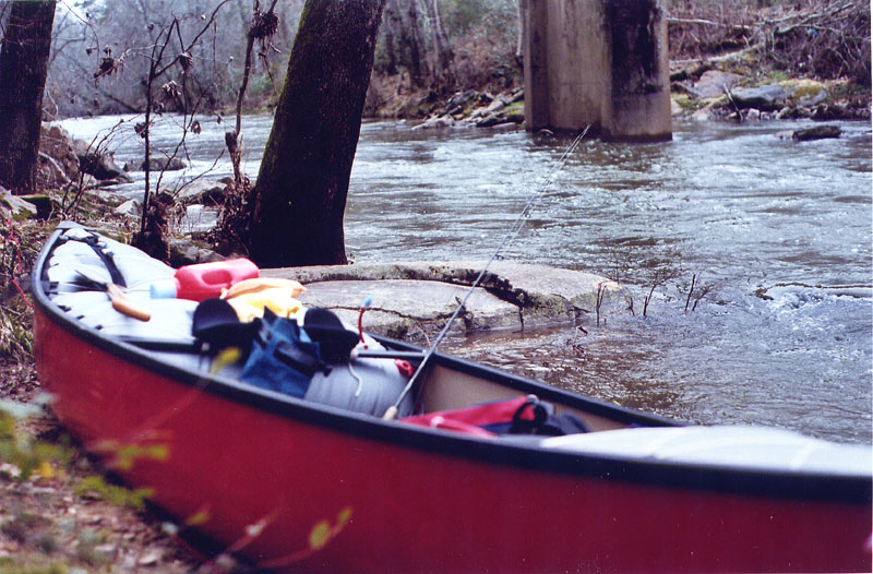 Floatation is a good idea anywhere on the Mulberry
So, first I drove the canoe up to State Road 67. The access is steep, but a short carry around the rock ledge on the downstream river right side was possible. I took my 16' Mad River Explorer (with my new carry yoke on the center thwart) off the truck, carried down to the river, and locked it up. I stashed my extra gear in the woods nearby. Secondly I drove my truck (with a Trek Road Bike in the back) back down to the take out. There is great parking at the downstream river left side at U.S. 231. I left the truck there and began my first serious bike ride in probably ten years.
My shuttle route was west on U.S. 278, then north on County Road 1742. The traffic was heavy on 278, but the distance was short. Traffic was minimal on 1742, but there was the occasional chicken truck passing through with it's wonderful aroma. I also encountered a few loud, but harmless dogs along the way. I took a right on County Road 1725 to shorten the distance slightly. I then took a right on State Highway 67 and peddled the short downhill ride to the put in. Overall the ride was about 10 miles, but none of the hills were especially steep. It took 30 or 40 minutes in all.
The word is that the owner of the property at the HW 67 bridge downstream river right is friendly. I did not meet him, but be careful not to block his gate to his craft shop if you park there. There is enough room on the shoulder to park 1-2 vehicles here.
The run itself started out with a number of minor shoals and a few interesting logjams. I can only recall one logjam that I had to carry over. You could squeeze over or around the rest at this level. At higher levels, some of the log jams could become serious strainers for the unprepared. The whitewater action picks up, and the logjams disappear after Pan Creek on river right adds to the flow after the second mile.
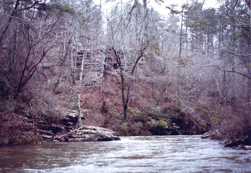 Nice Bluffs!
I enjoyed several nice drops. There was some good scenery with picturesque bluffs along the way. The river did have some trash in it though, and there was that faint smell of the chicken farms. Apparently many of the property owners along the river don't care about keeping the stream clean. I was surpirsed there were only a few cabins. However, there were a several areas with rope swings that looked like places where the locals party and swim in the summer.
 The best of the drops (a little blurry)
I'd love to run it again directly after a big rain when the lower Mulberry is too big. I imagine the redeye and spotted bass fishing would be pretty decent when the the water warms up, and slows down - in the late spring.


