**This is not Brushy Creek in the Bankhead National Forest
***This stream is in lower Alabama (and MS)
There are countless small waterways that are named "Brushy Creek" in the state of Alabama. This particular Brushy Creek is a tributary of the Escatawpa River that has some interesting shoals, followed by very challenging logjams.
The stream begins in Greene County, MS near the community of Pisgah. It flows southward into George County, MS. Scarborough Creek and Tennesse Creek add to the flow. Brushy becomes just large enough to paddle at Brushy Creek Road. Then the flow begins to head southeastward for four miles, crosses the Alabama line, and flows another 1.5 miles before hitting the Escatawpa.
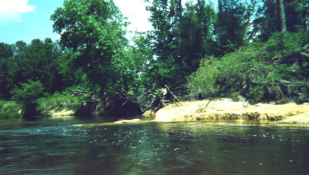
 Here is another shot of the unique claystone ledges.
The stream cuts through a layer of sandstone and claystone with gradient of about 7 feet per mile. There are several extended shoal areas in this twisty, swift area of stream. You also will encounter one class I drop of about three feet. Much of the land along the creek is posted. Proceed with caution. You will see several cabins along the way. The flow flattens out two miles above the Escatawpa. The streambed becomes sandy in nature, and the occasional logjams become more numerous. Brushy enters the Escatawpa 2.5 miles above the HW 98 access.
The best way to navigate Brushy Creek would be in a small, light tandem canoe with two paddlers to help carry over the logs. A small sit on top kayak would also work very well. The creek is very narrow and paddling a longer sea kayak would be problematic. Sit-in kayaks like "Pungos" might work, but it would be more dangerous due to the logs and strainers. Pack a light amount of gear to make the portages easier.
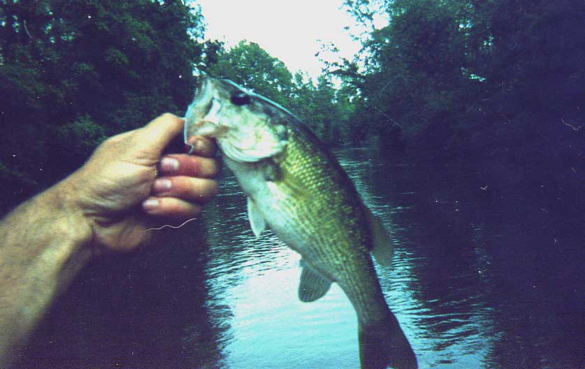
 Logjams and spotted bass co-exist along Brushy.
From a fishing perspective, it would be difficult to flyfish. The creek is just too tight. A short 5 to 5 1/2 ft. spinning rod with 6 lb. test is ideal. The spotted bass fishing is very good. They like 4" worms and small spinnerbaits. Bring some small beetle spins, because and there are also some very pretty longear bream that locals call "sun perch." See the report below.

The best way to gauge the level on this creek is the
Big Creek level, above Big Creek Lake. This is a similar stream, though slightly smaller, that is located 5-10 miles to the east of Brushy. Here is my best guess in translating the levels between Big Creek and Brushy Creek. High levels could be dangerous due to the numerous logjams and strainers. For a visual level, if you can run the first shoal just downstream of the bridge, you should be fine.
5.5ft, 200 cfs - High
4.5 ft, 100cfs - Medium (Best)
3.5 ft, 50cfs - Low (Best for Fishing)
3.0 ft, 40 cfs - Minimum
 Curtis shows of a nice Brushy Creek Spot.Trip Report
Level: 3.0
Flow: 48 cfs (falling slowly)
Best Gauge:
Big Creek above Big Creek Lake, or visual.
Clarity: Clear
Weather: Upper 50's, Cloudy
Section: Brushy Creek Road-HW 98 (5.5mi on Brushy, 2.5mi on Escatawpa)
Curtis and I paddled Brushy on Sunday, February 4th 2007 in a tandem Mad River Explorer 16'. A shorter 15' canoe would have been even better. The question is, are the logjams worth it? The fishing is really good and the shoals are neat. The logs are especially bad in the lower section, partly due to Hurricane Katrina. They slow the trip down big time. I am ready to do it again. Curtis says he would prefer a more open stream like Little River in Baldwin County or Big Escambia Creek.
 Most fish were 1-2 pounds...
We set out from Mobile at 10:30am, arriving about at the Brushy Creek Road put-in bridge 45 minutes later. We unloaded the canoe and fishing gear. Curtis' road bike was our shuttle. We decided to flip a coin to see who was going to have ride the bike back up.
The idea was to drive the truck with the bike in the bed back to Escatawpa Hollow, and leave the truck there. The unlucky loser then had to bike it up HW 98. And, then turn right and peddle north on Beaver Creek Road until it merges with Brushy Creek Road and the bridge. The winner got to set up the canoe and gear, and then ease upstream and fish a little. Curtis called heads, the coin said tails. Curtis had to ride. The agreement was that I get to bike the shuttle next time.
I was a bad judge of time. Curtis waited 20 minutes at the bridge while I fooled around with some spotted bass upstream. We finally got on the creek about noon. I told Curtis I was sorry he had to wait. But, that he would love the creek. It was full of fish. Curtis said "I booked it down 98, and it wasn't fun with the 18 wheelers. But, the ride up the country road was great."
 This pose is beyond cheesy.
We caught fish right away. We caught six fish out of one pool in the first mile. The spots were hitting 4" black finesse worms with a 1/0 EWG Gamagatzu hook and 1/8 oz. or 1/16 oz. screw-in head weight. I also had good look with the 5" Gulp shaky worm. Throughout the afternoon, we caught a good 20 or so fish. Some of the spots were smaller - around a 1/2 to 3/4 of a pound. We both caught several fish well over a pound. The fish were found in most of the deeper holes and bends. The ones we didn't catch were visible in the clear water as we canoed downstream. Later in the run, I switched to a small 1/8 mini king spinnerbait. It seemed to work just as well.
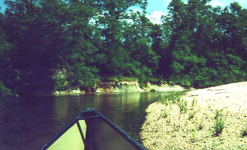
We encountered some really neat shoals in the first 3-4 miles. There were several sections where the light shoals would continue for 50 yards or more. One drop was a definite class I, even at this lower level. It was a good three foot ledge. I would imagine it would be very fun when Big Creek is running a 100 cfs or so. The upper section did contain a few logjams, but nothing major.
 Holding onto a branch with your teeth keeps the boat still and both hands free for fishing.
The fishing seemed to slack off a little towards the bottom. We still caught a few, but the holes were not as deep. You also would find the holes right behind the log jams. By the time you got the boat over the jam, the fish were spooked. We were also in a hurry. We were running out of daylight. In the last mile or two, we were hoping the Escatawpa was right around every bend. Instead we found some tricky logjams. Most were low enough that we could slide the boat over the log. Some logs were low enough in the water to slide over. Twice though, we had to get out of the creek and carry through the woods.
 Escatawpa at night. There are more photos on my 35 mm that show Curtis and the Creek. Coming soon.
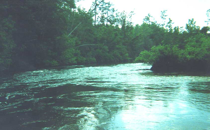
We reached the Escatawpa just after sunset. It was pretty much dark. We had a good 2.5 mile paddle left. The Escatawpa was pumping at 1230 cfs so the current helped us along. The sandbars stood out in the fading evening light. A full moon rising in the east brightened the sky a little. We made good time in the swift current. It wasn't long before the noise and lights of HW 98 appeared in the distance.
It was a challenging paddle and six hours is not enough time if you plan to fish.