Monday, May 22, 2006

Upper Tallapoosa River


Tallapoosa River


The Tallapoosa River forms near Buchanan, Georgia at an elevation near 1,200 feet. The headwaters are approximately 40 miles west of Atlanta. Here it is mostly wade fishing for Redeye and Spotted Bass with good water quality. This Piedmont stream begins to take on a much more pastoral nature near Tallapoosa, Georgia.

The Tallapoosa then flows generally southwest in to Alabama just north of I-20 at an elevation of 900 feet. The water becomes more stained, but the river still cuts through some scenic bluffs lined with Mountain Laurel. The rock formations are igneous and metamorphic. They often appear folded and faulted along the deep river bends. The river is generally placid and floatable most of the year, all the way to Lake Wedowee. The gradient in the 18.7 mile stretch from the Georgia line to I-20 is 2.6 feet per mile. There are occasional minor rapids and ripples that occur below I-20. The gradient below I-20 is 3.74 feet per mile. Also, you can find occasional gravel bars for river camping. The 44 mile stretch above Lake Wedowee has been designated as the Loyd Owens Canoe Trail. There is an outfitter, Lex Brown at Tallapoosa River Outfitters, who makes this float very convenient.


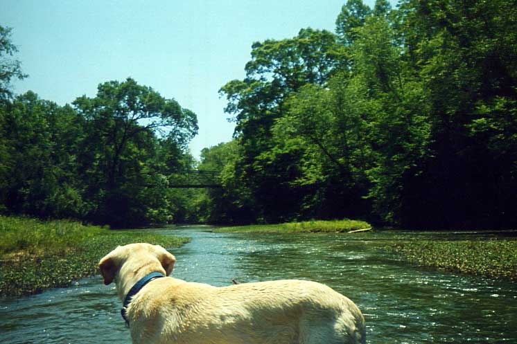
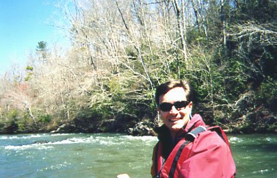
Doc Looks Downstream


Trip Report

It was late May and the streams of Alabama were setting into typical summerlike levels. Curtis Wright and I were looking for a overnight canoe camping river in Alabama with an outfitter service. Temperatures were also heating up and we wanted to get far enough north for pleasant overnight temperatures. The only other option was the Cahaba and this looked more interesting. I have not ever floated a piedmont stream and figured this was a good opportunity to experience a new area in the state. We loaded up the truck with my Explorer canoe, Curtis' Necky sea kayak, canoe camping gear, and my dog Doc and headed north. We floated on a section of Choccolocco Creek (running 600 cfs) on Friday and camped at Cheaha on Friday night. Saturday morning, we met Lex Brown (256-239-6399) at Tallapoosa River Outfitters.

Day One
Access at Liner Road Bridge-Campsite above I-20
Distance 15.25 miles

Lex helped us load our boats and gear on his Chevy Suburban and took us to the Liner Road Bridge near Tallapoosa Georgia. His shuttle service allowed for us to paddle a 26 mile trip through a remote section of the river. It hadn't rained in 6-7 days and the river was running just under 4 feet (380 cfs) on the USGS gauge. On Saturday morning, we began fishing along the Georgia/Alabama line and I caught a decent 1 pound spotted bass on my first cast. He hit a 4" finesse worm rigged Texas style. This was a bad omen. We didn't catch another fish until after lunchtime. And, we fished very hard.


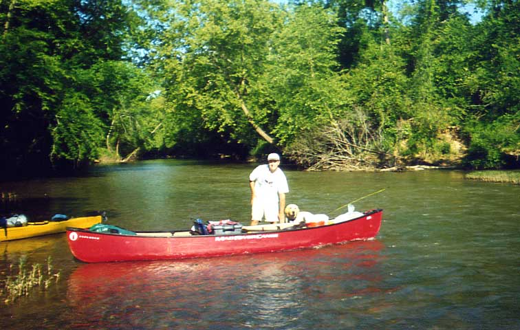
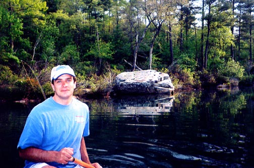
Gear, Dog, and Redeye Bass


I finally switched to a small beetle spin and picked up a decent 3/4 pound Redeye Bass. I released both the spot and the Redeye. We had plans to have fish for dinner, but initially it seemed that catching a few fresh fish in the evening wouldn't be problem.

Fishing hard, and paddling very little, we average about one mile per hour as we floated through a low gradient section of the Tallapoosa. This upper section was mostly forested. A railroad track follows the river on the north side for the first 2.5 miles. Also, we noticed a Georgia State flag dangling across the river on a rope, at what was presumably the state line at mile 1.2. The river had a clarity of about three feet with a muddy tint. There were very long stretches between riffles. In the long flat stretches, the water averaged 3-4 feet in depth. The banks were muddy and lined with fallen trees.

We saw a large number of wood ducks. I trained Doc, my lab, to hunt ducks with me in the winter. He was very eager to keep track of all the waterfowl. Occasionally, we would encounter small rock bluff areas, and blooming laurels. The water clarity seemmed to improve in the small riffle and shoal areas. The upper river probably would have been more memorable if the fishing was better. Curtis and I felt that the fish were there, they just weren't biting.


Upper River


After an MRE lunch, the fishing picked up somewhat. I had nice battle with a 4-5 pound flathead catfish that hit a 1/4 ounce spinnerbait. I lost the fish on a stump in mid-river towards the end of the fight. I was also surprised to catch a Rock Bass on the spinnerbait. As the afternoon progressed, the I switched to a beetle spin and picked up numerous redbreast and bluegills in efforts to catch dinner. At mile 8.0, we squeezed passed a log jam at the CR49 bridge.
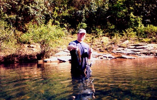


Redbreast Sunfish


Fortunately, Curtis stayed with the worm. He caught a nice 2 1/2 pound spot. We didn't get a picture of it. He said it was a very tough fight that lasted several minutes. So, with dinner on the stringer, we picked up the pace with our paddling.
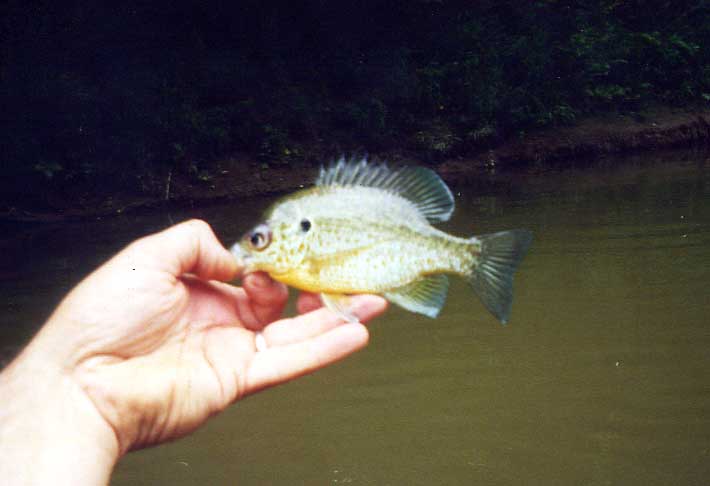


Redear Sunfish


We passed the Dryden's Mill campsite and access at mile 12.5. It was loud with music, crowded with vehicles and local kids. We pushed on. After paddling a total of 15.5 miles for the day, we camped about one mile below the CR 66 bridge. We found a decent campsite on a gravel bar on river left. Two deer were on the site as we approached. The bugs weren't too bad. We had the ThermaCell going just in case. Curtis' fish ended up getting lightly battered, and pan fried for dinner. It was very good table fare. In addition to the fish, I cooked some Orzo with peppers and onions. It was tasty.


Day Two
Campsite above I-20 to Bell Mills


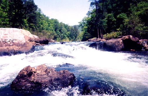
Curtis Runs a I-II Rapid in the Necky


After a nice breakfast of bacon, eggs, and grits... We paddled and fished on, at a bit faster rate through the remainder of the trip. The gradient increases to almost four feet per mile below I-20. The scenery was a little better through this stretch. We also caught more fish. I stayed with the standby 1/8oz roostertail spinner on my Loomis ultralight. I had no trouble catching various sunfish species. We caught mostly redbreast and bluegills. I did catch one redear sunfish (shellcracker). Curtis caught a bream or two, and also picked up two spotted bass.


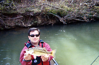
Curtis with a Small Spot


We passed several bridges on the second day trip. The areas of fast water and shoals were a more frequent sight. We also saw more impressive rock formations along the way. The best rapid on the trip was just above a bridge, I believe it was CR 71. This could be a better play spot at a level of five feet. Next time, we might try floating from CR 71 to an access point further down below Tallapoosa River Outfitters. When we made to Lex's place, it was mid afternoon. Our truck was waiting for us behind a private gate.


Curtis Shows Off a Bit Nicer Spot


Some notes about canoe camping

There are several items that I have found very helpful over the years. The bottom line is: When you have a 16' open canoe with plenty of room, why not camp in style ?

1) Seal Line Dry bags are mandatory. You need your tent, sleeping bag, full size therma-rest, and clothing to stay completely dry. Don't forget to lash or clip these bags in the boat...

2) The ten gallon bucket with tight fitting lid. This is part one of my kitchen. My round MSR guide cookset fits perfect in the bottom of this bucket, along with my plates. I also store my mugs, bowls, seasoning and utensil kit, paper towel rolls, water purifier, and canned /dry goods in the bucket. It seals water-tight and serves as a mini-table at the campsite. You can use a caribeener or rope to lash it in.

3) The Rubbermaid container. This is part two of the kitchen. My Coleman double burner stove and extra fuel bottle fits perfect in the bottom. And, I measured the container to make sure it fits nicely between the gunnels and thwarts of any canoe. Your tarp, tarp steaks, tarp poles, ground cloth, Lantern, and even a towel can fit in too. You probably want to run a rope or bungee strap around the container and a thwart to keep it secure.

4) The cheap lawn chair. Why not be completely comfortable ? In a 16 foot canoe, you have tons of room. This is a great comfort around the campsite while cooking or sitting on the river bank. If you feel stable enough and you are not in a hurry, you can even sit in the chair while you paddle. The standard folding lawn chair only weighs a pound or two...

5) Other items. Nalgene bottles. Extra Rope. Waterproof matches. ThermaCell/Deet. Bull Frog Sunscreen. Soap/Shampoo. Flashlights. MRE's for lunch. Small cooler. All the comforts of home...

Choccolocco Creek

Choccolocco Creek begins in Talledega National Forest east of Jacksonville, AL. After leaving it's forested headwaters, this creek flows south through a pastoral setting and a portion of Ft. McClellan Military Reservation. The state record Redeye bass comes from its waters. Terry Johnson brought in a 3 pound, 2 ounce bass while using a 5- to 6-inch sucker for bait in March 8, 2000. The fish was caught, presumably in the lower Choccolocco.

Here, agricultural and urban runoff take there toll on Choccolocco, especially below HW21 and the Anniston/Oxford Exit on I-20. In fact, there is supposedly a high level of PCB's and a health warning on the fish below Anniston. This is a low gradient stream with rock bottom, and occasional class I shoals. It is very similar to Big Wills Creek in nature.

Trip Report (Wild Goose Chase)
Choccolocco Creek
Mellon Bridge Road to boiling Springs Road

The plan was to drive up from Mobile on Friday in the direction the Upper Tallapoosa River. Curtis Wright and I had plans to paddle on an overnight trip on the Tallapoosa Saturday and Sunday. We wanted to camp near the river in the Talladega National Forest, and wade or float a stream nearby on Friday Evening.

We scouted a National Forest Primitive Campground east of Ft. McClellelan on Shoal Creek. It looked good on the map. But, the site was low and marshy. And, the creek was soft bottom and the banks were lined with nettles and snakey looking grass. We were riding down the road in one Toyota Tacoma Truck loaded down with one 16ft Explorer canoe, one 16 ft Necky Sea Kayak, and my 90 pound yellow lab named Doc. Our options were limited.

We backtracked south on HW 9, and kept noticing Choccolocco on the Delorme map off to our west. There are a significant number of access points above and below I-20. It was May the 19th and the all the rivers in the state were low. However, Choccolocco is surrounded by mountains. It's lower elevation and large watershed make it floatable for most of the year. So, at the late hour of 5pm, we squeezed in a short float. Curtis dropped Doc and I off at Melon Bridge. Curtis then drove downstream to Boiling Springs Road Bridge. He paddled upstream there and fished the lower section.

I had the luxury of portaging an easy logjam at the bridge, and then ran a straightforward Class 1- rapid and the float was on. This is the only significant rapid on this stretch, but the flow was swift. I caught one decent redeye, one decent spotted bass, and numerous bream. Some of the bluegills were over a 1/2 pound. I also caught redbreast and green sunfish. The fishing action was good. The smells from the nearby pastureland were occasionally a pit pungent. After about an hour and approaching dark, I met Curtis. He had made it up about a mile above the takeout, paddling against the current in his Necky. Curtis caught a few fish too. We headed downstream to the takeout in time to load up in the fading daylight. We camped that night at Cheaha State Park at 2,400 feet in elevation.

Thursday, May 04, 2006

Hatchet Creek 5/6/2006

Upper Hatchet Creek
US 280-US 231


I took the fairly short 200 mile trip (3 hours) up I-65 from Mobile, meeting my friend Curtis Wright coming from B'ham at the Verbena exit on I-65 at 8:30 Saturday morning. After discussing the river level and wanting to both paddle and fish, we opted for the 280-231 run of the Hatchet.

We ran it in my 16 ft Mad River Explorer and probably scraped rocks a dozen times, but never had to drag or get out of the boat at this level. I want to run it again when weve had some rain. Overall, we were glad we made this very scenic upper run.


The whitewater action was a little better than I expected. The shoals are spaced between short pools. There is one solid class II drop and two or three other drops that are borderline II. Lots of class I-II shoals. The river widens a little in the last two miles and this is were we encountered a little scraping in the shallower ledge areas. I would think that above 1000cfs, this would be a real nice solid class II float. We had a few minor splashes in the boat and got a little water while surfing a small hole about halfway into the run at this minimal level..


The scenery is outstanding, especially for Central Alabama. The water was very clear, lots of wildlife. We had two deer swim the river ahead of us in a class I-II shoal area.. We got very close to them as they reached the left bank, they panicked and scaled directly up a 25 foot semi vertical rock face. One fell back into the river, regained her footing and scrambled back up like a mountian goat.

The fishing conditions were very tough. Strong north wind and a cold day in the mid 50's, but the spotted bass were still biting surprisingly well. We did catch 2 of my favorites - Redeye Bass. Lower Hatchet CR18-Kelly's Crossroads We camped Sunday night in the Hollins WMA below Cheha Mtn., ate in Sylacauga at Old El Paso (Mexican), and then drove to Rockford Sunday morning to run the "Lower Hatchet."

Lower Hatchet Creek
Above Lake Mitchell


This is a wider run that starts of with some flatwater stretches. Its not as scenic as the 280-231 run but it has its moments, and was perfectly floatable at the 450 cfs level. You could likely padlle this section at 400 cfs, but below that level, it would be pretty bony. The fishing was not as good on this run, probably because it sees more pressure than the upper runs. Curtis is pictured with one of the few fish we caught Sunday morning.

Again, there is one class II drop and and the other shoals are I-II and overall a little easier than the upper run. It is 8 miles long with numerous cabins along the way. It was a good second day, half day paddle. This was one fine creek overall.

Wednesday, May 03, 2006

Little River Canyon 5/6/2005

Little River Above HW 35
River Forks to Just Above Little River Falls


Starts as easy Class I, then rapids have one class II drop and numerous shoals from Hartline Ford to HW 35. Total run is 6.0 miles. Access along FS road 5 and FS road 3 is fine in 2wd if you have good clearance. Numerous hard bottom stream crossings, but gravel improvements have made the roads much better. The roads can get a little tough on 2wd rear wheel drive pickups after a hard rain. 500 cfs is the minimum for this section, and 750 or above is a much cleaner run. Can be run at lower level than the East Fork, which needs at least 1000 cfs... This is a nice lower water alternative for the intermediate boater.

Trip Report

Tim Cook from Jackson met me in Birmingham on Friday and we drove up in two vehicles to Valley Head, Alabama. We set up shuttle and squeezed in a trip from Hartline Ford to HW 35 Friday afternoon. Putting in at Hartline Ford has more action and is a shorter - about 4 miles. This great short run that can be done in 2-3 hours.

We ran it at the absolute minimum 450 cfs. I had to get out and portage the class 2 drop in this section because it was too low. Minimal whitewater levels translate into great fishing levels though. The bass bite best when the water is clear and falling. We catch and release all fish in this river.


We had no trouble picking up nice Redeyes and some decent sized bream. I picked up an impressive 14" Redeye on my flyrod. I had to jump out of the canoe and wade in the current to keep this fish off the rocks. Wade fishing is ceretainly a lot more effective than canoe float fishing if you are going to pull out the flyrod. What a fight!


Tim caught a nice redeye wading up the East Fork. The black 1/8 oz roostertail was magical. We returned to this section of the river after a canyon run for a more scenic evening float on Saturday.


We paddled and pulled upstream to the river forks. You could wade up the West Fork too. The rocks are slick and the pools are deep. Tennis shoes and shorts are the best option. Even in May, the water is warm enough to enter without waders.


Tim also caught several nice fish as we floated back to Hartline Ford. I focused on the bream with a 1/16 hellgramite jig and had consistent action. We caught redbreast, warmouth, and green sunfish. This is a quiet and scenic stretch of river that makes for a good canoe float trip..


Little River Canyon
Powell Trail to the Mouth Park


My friend Tim Cook and I paddled this section in an old tandem Blue Hole with questionable floatation, so we didn't want to deal with the Bottleneck section of the river, thus putting in at Powell Trail. We were in my great old friend Larry Longshore's boat, if anyone remembers Larry - a die hard paddler from the Tennessee Valley Canoe Club who was from the Valley Head area. Larry passed away a little over five years ago unexpectedly. He was one of the first to canoe the Nantahala in the 70's, as well as the Little River sections. In an open canoe, even the 350 cfs run we made was the extreme minimum.


A few clean rapids, most were bumpy at this level, and there is one solid class III about two miles down from the Powell trail - better to run it solo. To be honest we flipped it running it tandem. I ran it successfully solo, and then we survived a second tandem attempt, only to T-bone a rock at the lower end of the rapid. I wouldn't make this run it again unless I had 500 cfs or better. Absolutely outstanding scenery and water quality. We did not fish. I saw plenty of very large gar in the rapids above the mouth park. This is a good set of rapids and we figured it was best to leave the rods in the truck instead of watching them sink in the canyon. One day at low water, I want to go back and wade this beautiful spot.


Monday, May 01, 2006

Buffalo River 6/13-6/15/2005

The Buffalo National River is a free-flowing, low gradient waterway that cuts through the heart of the Arkansas Ozark Mountains. This plateau-like range peaks at the headwaters of the Buffalo near Red Star and Fallsville at an elevation of 2,200 feet. The river begins as Class II+ seasonal whitewater stream above Pruitt, Arkansas. It then quickly settles to a class I-II float river, ideal for extended canoe camping. The distance from Boxley Bridge to Buffalo City is 131 river miles!


The best whitewater action is in the upper third of the river. The scenery is great throughout the river, especially in the middle third of the river from Pruitt to Gilbert. The lower Buffalo is extremely easy stretch with long pools, limited access, and dramatic bluffs. The entire stretch of the river is protected by the National Park Service, controlling over 100,000 acres. The Buffalo sees plenty of crowds on summertime weekends, especially on day trip sections. There numerous outfitters along each section of the river and theaccess points are easily accessible. If you like clear water, gravel bars, and wary smallmouth bass the Buffalo is the place for you...


Trip Report
Woolum to Gilbert


We loaded down the Toyota Camry in St. Francisville, LA. Emily, her brother Adam, and I began the long journey to the Arkansas Ozarks and the Buffalo National River. We camped the first night at Richland Creek out of the car. I caught a few smallies wading here near the campsite. We slept here and prepared for Day One on the river.


Arkansas was in the middle of a serious drought by the time we made our trip. River levels were an issue at 3.8' at St. Joe, closing all of the Upper River. We opted to drag a little bit of the section just below Woolum in order to have more privacy. And, we did indeed have to do some dragging, especially the inflatable kayak. We also had the section of the river to ourselves for the most part. I also chose a shorter overall trip for this three day, two night paddle. In 1996, I paddled a 47.5 miler from Pruitt to Gilbert with little effort, the level then was a brisk 7 feet.


The springs at Margaret White Bluff was a neat area at this level. The river went from being virtually devoid of fish, to a stream full of all species. The water was refreshingly cooler here. We camped the first night at the Slay Branch/Cemetary area. The site was level and large, but the view wasn't exactly spectacular. There were visible scars of the 2004 flood at our site, with washed out banks.


We made a short paddle on day two earning a very fine campsite at the rivers edges near Whisenant Bluff. We specifically camped 1/4 mile up river from a spot labeled the "hangover" on the Trails Illustrated map. The river was all ours here, with a nice smallmouth hole down below. We enjyed a nice class I shoal chuckling over the rocks right by the tent. The weather was outstanding, with overning lows near 60 and low humidity. We passed another outstanding looking campsite at Peter Cave Bluff. I found that laying your map out in a Seal Line Map Case made it very easy to track our progress down the Buffalo. A GPS also comes in handy. Other items you need are Seal Line Dry bags, a water tight 10 gallon bucket, and of course - lawn chairs.


Day Three on the river was a 12 mile paddle to the landing at Gilbert. The scenery on the stretch is absoutely outstanding. I jumped off the rock at 40 ft. high Smart Bluff. Make sure you go river right at Arnold Bend. We noticed a lot of new faces on the Buffalo begining near Bakers Ford. This is a day launch area. Even though there were lots of people on the river, it was still strikingly beautiful. The limestone bluffs are amazing.